Nepal
Country
Year Round
Dates
21 Days
Duration
Trekking
Activities

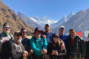
Annapurna Circuit Trekking is the most important and most famous trekking route in the Annapurna region. Overall, the Annapurna Circuit is considered to be the classic trek in Nepal to experience the vast biodiversity and cultural heritage Nepal is renowned for.

We will commence our trek with an overland journey to Beshi Sahar, 130 km West of Kathmandu where we overnight. Our trek follows the gorge of Marshyangdi river through lush paddy fields, innumerable tiny streams, waterfalls and beautiful villages, eventually emerging into high desert country from Manang (3597m). The trek gains in height fairly gently reducing the chances of altitude sickness. However, we spend a day acclimatising before crossing the Thorong-La (5416m). From a high lodge camp we are up early for our crossing of the Thorong- La (spoiler alert: tremendous high mountain feelings) before our decent to Muktinath. This place in the lower Mustang region is one of the holiest pilgrimage sites for Buddhist and Hindu people in Nepal.

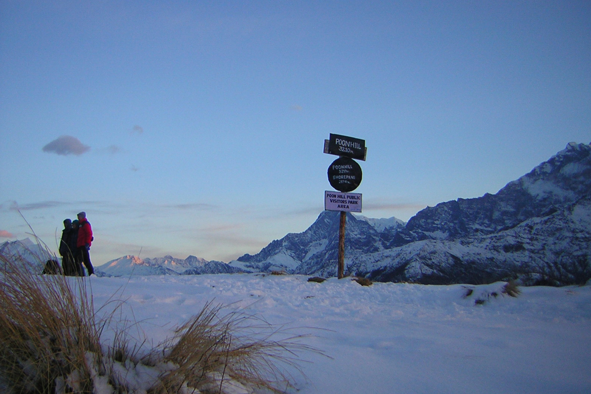
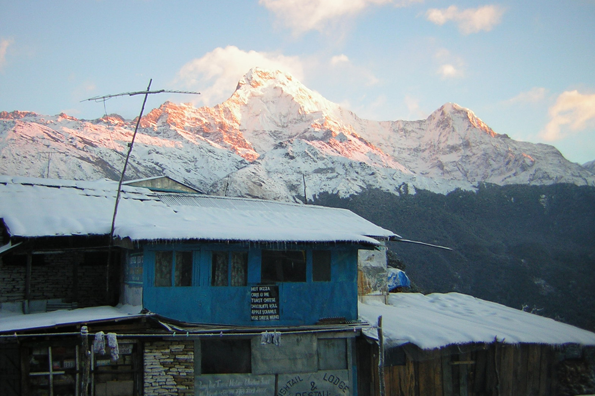
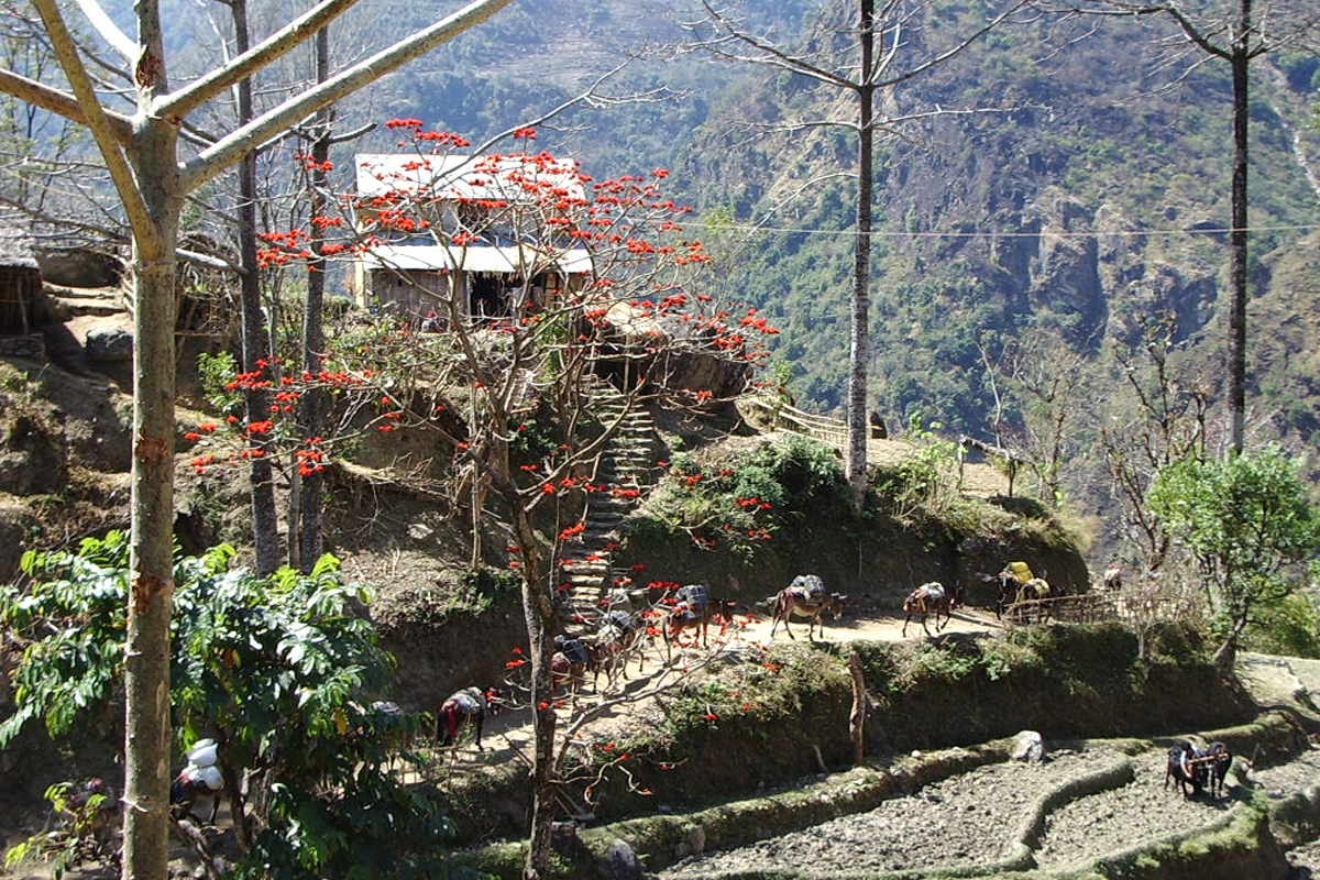
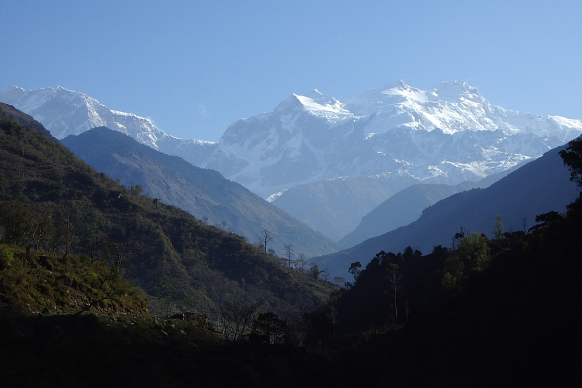
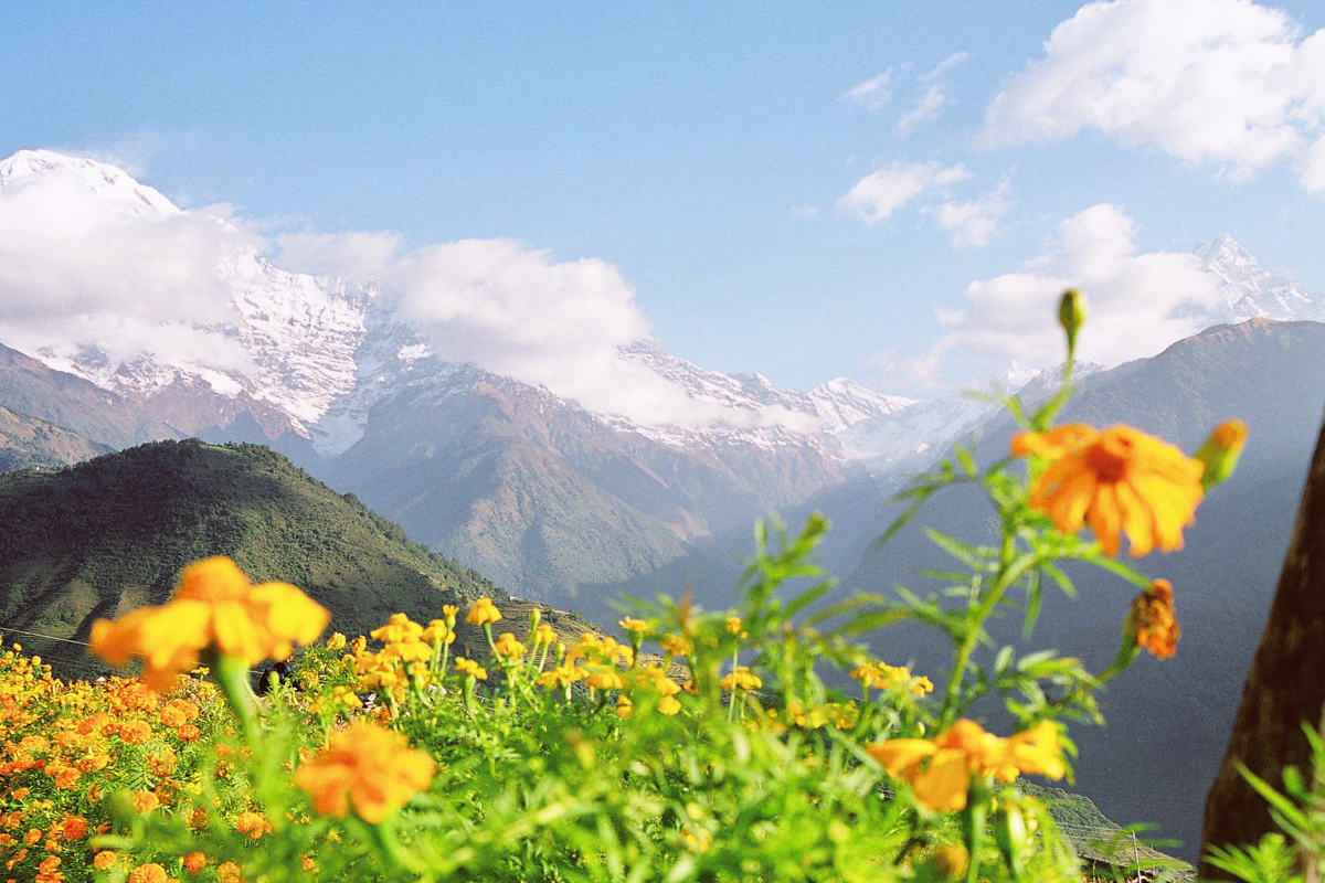
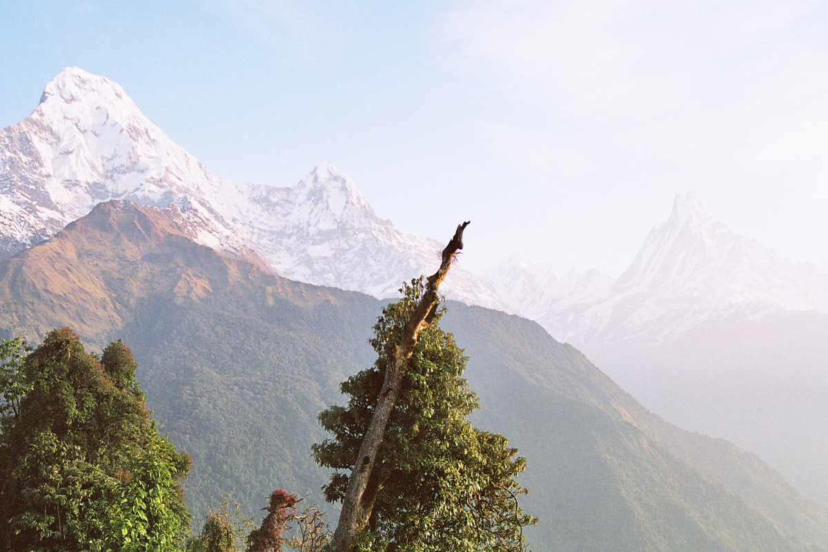
We continue through the dry arid landscape to Kagbeni, a fascinating historical fortress town. The trail back follows the Kali Gandaki River to Jomsom beneath the shadow of immense Himalayan peaks and through the deepest canyon in the World. We descend to Tatopani before ascending to Ghorepani and Poon hill for some tremendous sunrise views of both the Dhaulagiri and Annapurna Himal. A further two days are spent trekking through beautiful Rhododendron bamboo and Oak forest before eventually reaching Nayapul for a short drive to the beautiful lakeside town of Pokhara.

Itinerary Outline:

01 Drive Kathmandu to Besisahar (760m) by local bus (approx. 6 hrs drive)

02 Besisahar to Bahundanda (1310m) – 5 hrs walk

03 Bahundanda to Chamje (1430m) – 6 hrs walk

04 Chamje to Dharapani (1860m) – 6 hrs walk

05 Dharapani to Chame (2670m) – 5 hrs walk

06 Chame to Pisang (3200m) – 6 hrs walk

07 Pisang to Manang (3540m) – 4 hrs walk

08 Rest day in Manang

09 Manang to Yak Kharka (4018m) – 5 hrs walk

10 Yak Kharka to Thorong Phedi (4450m) – 4 hrs walk

11 Thorong Phedi to Thorong Pass (5416m), descend to Muktinath (3800m) – 8 hrs walk

12 Muktinath to Kagbeni (2800m) – 3 hrs walk

13 Kagbeni via Jomsom (2710m) to Marpha (2670m) – 5 hrs walk

14 Marpha to Kalopani (2530m) – 6 hrs walk

15 Kalopani to Tatopani (1190m) – 6 hrs walk

16 Tatopani to Shikha (2830m) – 5 hrs walk

17 Shikha to Ghorepani (2750m) – 3 hrs walk

18 Ghorepani to Ghandruk (1940m) – 7 hrs walk

19 Ghandrunk to Pothana (1900m) – 5 hrs walk

20 End trek at Phedi (approx. 3 hrs walk), drive to Pokhara (approx. 30 min drive)

21 Drive back to Kathmandu

1

Drive Kathmandu to Besisahar (760m)

After breakfast, you will drive to Besisahar (approx. 185 km), which takes about 6 hours. You will drive past beautiful landscapes and traditional villages and get a first impression of Nepal. Overnight at guest house.
2

Besisahar to Bahundanda (1310m)

Todays trek begins to introduce us to the many cultural elements of Nepal. You will come across typical Nepali houses and the different faces of the local people, exchanging greetings as we pass. We’ll be crossing the suspension bridge at Besisahar to the eastern side of the Marshyangdi River and climb up the trail. The trail has a mix of ascent and descent as we pass small valleys, the diversity of Nepali people is clearly seen in the faces of the local people we meet as we pass through the villages. Nadi is a settlement of families originally from Manang village while Taranche, immediately above it, is a Gurung village. The last hour and half we climb uphill to reach Bahundanda, where we stay overnight.

Walking time: 5 hours

3

Bahundanda to Chamje (1430m)

From Bahundanda we gain slight altitude to reach Chamje. Drop down from the ridge on which Bahundanda is perched and follow the river to Syange, where we cross the river by suspension bridge. From here we climb uphill for about an hour to the village of Jagat, there are some great views of the river below as well as of the waterfall across the river. Chamje is another hour and half following the river.

Walking time: 6 hours

4

Chamje to Dharapani (1860m)

The route today passes villages and local communities that are said to have migrated from Tibet a long time ago. As we trek you will feel the difference in the lifestyle of the people and their settlements. We cross the suspension bridge below Chamje and climb two steep sections of the trail to reach the village of Tal. Tal is populated with Gurungs and Tibetans. From the end of the valley above Tal, the trail rises steeply initially and then rises and falls as it cuts across the mountain side to Dharapani.

Walking time: 6 hours

5

Dharapani to Chame (2670m)

Today the trail mostly climbs up as we increase in altitude, you will find that even though we are not walking for that long each day, you do consume a lot of energy. We reach Bagarchap, a Tibetan village, within the first hour of today’s trek, followed by Dangyong, a small Tibetan settlement shortly afterwards. We then enter dense forest, cross bridges over tributaries and at the foot of a waterfall ascend steep stone steps to reach the new trail to Chame. It will take us about 3 and half hours with some fine views of Annapurna II on the approach to Chame.

Walking time: 5 hours

6

Chame to Pisang (3200m)

Today’s walk passes several rivers and so we climb up and down between them. From Chame, we reach the small settlement of Taleku, in approximately forty minutes. In just under two hours, we cross a bridge to the sparsely inhabited settlement of Bartang. This former Khampa settlement is now an orchard and marks the traditional boundary between the Manang area to the north and the predominantly Gurung area to the south. From Bartang, we follow the river for forty-five minutes, cross the bridge and then ascend to the floor of the Manang valley and Lower Pisang. A spectacular rockwall is in view for much of the climb. You will notice a real change in the landscape as the area becomes much more arid as we climb.

Walking time: 6 hours

7

Pisang to Manang (3540m)

The trail continues to climb and by now, you will be encountering the windy and dry atmosphere of the area. This is one of the reasons that makes Manang a special place of interest for the visitors. The trail rises, first gradually and then more steeply from Lower Pisang to reach the crest of a ridge overlooking the upper Manang Valley. The airfield and settlement area of Ongre are clearly visible from this vantage-point. We then head down to the flat valley floor and reach Ongre, shortly after this we cross the Sabche Khola River with a great view of the amphitheatre formed by Annapurna III and IV. Watch out for the village of Braga, built impressively into a cliff-wall. Manang is about half an hour past Braga.

Walking time: 4 hours

8

Rest day in Manang

Today will be day for acclimatization, allowing our bodies a chance to adjust to our increase in height over the past days. We will make some short hikes to explore the area during the day.
9

Manang to Yak Kharka (4018m)

The way slowly descends through the Manang village. The houses are made by clay and stone and joint each other. The path keeps on going up slowly by crossing the innumerable tiny streams, which come from the Chulu east and Chulu west.

Walking time: 5 hours

10

Yak Kharka to Thorong Phedi (4450m)

From Yak Kharka, we trek to Churi Latter, a small village with few houses, which takes nearly one hour. After a while there are two ways for Thorong Phedi. The first goes alongside the opposite side of the stream and the second goes along the same side but with a trek up. The trail alongside the river is a little bit dangerous because the rocks fall down very often from upside of the cliff.

Walking time: 4 hours

11

Thorong Phedi via Thorong Pass (5416m), descend to Muktinath (3800m)

Today is the biggest challenge, a long day as we start early to ascend to the Thorong La Pass. It usually takes around 7 hrs to complete the climb, before a 3 hr decent to Muktinath. The views of the Himalayas are magnificent as you climb up and cross this popular pass, so don’t forget to have your camera ready! Muktinath is a pilgrimage centre for both Buddhists and Hindus, as it is home to the Vishnu temple of Jiwala Mayi as well as several Buddhist monasteries. It is believed that all your sins are relieved when visiting this temple of Lord Vishnu. In an old temple you can find the natural spring and natural gas jets which produce the eternal flame of Muktinath, it is this combination of earth- water -fire that gives the area its particular religious significance.

Walking time: 8 hours

12

Muktinath to Kagbeni (2800m)

Having completed the hardest trekking, we mostly have descends in our remaining days. From Muktinath, the trail goes down through Kali Gandaki valley to Kagbeni. Gorge wide river will follow us along the way. We take it easy today after the strenuous walk yesterday.

Walking time: 3 hours

13

Kagbeni via Jomsom (2710m) to Marpha (2670m)

Today we descend to Marpha, which is home to many apple trees as well as all the various food products made from the fruit. Apple brandy is a local specialty that you may be lucky enough to taste en route.

Walking time: 5 hours

14

Marpha to Kalopani (2530m)

We follow the path on the west side of the river then on the new road through beautiful Thakali Villages with decorated houses and wide paved streets. We cross the river for lunch in Koketanti, then back again to follow the stone path through pine woods and fields to Kalopani. Kalopani is a very smart town nestling below the Dhaulagiri Icefall.

Walking time: 6 hours

15

Kalopani to Tatopani (1190m)

It is nearly all downhill today, mostly on paths through fields and orchards, but sometimes on the road being built by hand up to Muktinath. We stop for lunch at Rukse Chhahara, close to a huge waterfall. We continue on down into the deepest valley in the world to the town of Tatopani (hot water), where we can soak in the hot springs by the river before indulging in fish and chips in the town.

Walking time: 6 hours

16

Tatopani to Shikha (1935m)

Again we cross a the long suspension bridge over the Kali Gandaki then again Do Khola (stream), when the path goes rapidly up via Ghara and Shikha villages. You will gain about 1500m hight today. The stunning view of Mt. Dhaulagiri is just in front of you.

Walking time: 5 hours

17

Shikha to Ghorepani (2750m)

Today we keep continue to uphill trek through thick, lush Rhododendron forest. In spring season, the place looks like heaven, when the Rhododendron is in full bloom. Ghorepani is one of the magnificent villages in the area. A good place to see the inspiring view of Annapurna and Dhaulagiri massive.

Walking time: 3 hours 

18

Sunrise at Poon Hill, then trek to Ghandruk (1940m)

Early in the morning, we will climb for one hour to the top of Poon Hill. Poon Hill is one of the most popular vantage points of this trek, it is situated at an elevation of 3210m. From here we can see the tremendous views of Dhaulagiri and the Annapurna range. After enjoying the views for a while, we return to Ghorepani village and after breakfast start our trek to Ghandruk.

The trail climbs south on path through deep forests. It finally emerges on a grassy knoll which offers good mountain views, including a view of Machhapuchhare (not visible from Ghorepani) and a panorama all the way south to the plains of India. It is a similar view to that from Poon Hill. We climb along the ridge in pine and rhododendron forests to a crest at 3030m, then descend to cross a second pass, at 2960m. The trail then descends steeply to a stream before the climbing again through the forest to Tadapani. The trail descends steeply from Tadapani through the forest to a clearing, a short steep descent among rocks leads to a stream crossing then we descend gently pass other streams and finally down towards Ghandruk. The trail reaches the edge of Ghandruk near the tin roofed handicraft factory, and then descends on stone steps into the maze of the village itself.

Walking time: 7 hours

19

Ghandrunk to Pothana (1900m)

The trek from Ghandruk to Landruk is the steepest part of the entire trek. The descent from Ghandruk to Kyumi at the bank of Modi khola is almost 70 degrees vertical. Then have to climb up to Landruk which is almost equally steep but luckily shorter. A straight line distance between the two villages would not be more than 500 meters. From Landruk the trek is pretty easy for the first hour, somewhat steep for the next two or three (till Deurali) and a gentle downhill to Pothana through the forests. Pothana is a small town with 10 or 12 lodges and offer the best-so-far view of the Machhapuchhre.

Walking time: 5 hours

20

End trek at Phedi, drive to Pokhara

The remainder of the trek is gradual downhill through the village of Dhampus to Phedi. It takes about two hours to reach Phedi. Dhampus is the exit point of the ACAP region and foreigners need to check out here. Phedi is connected to the highway by a graveled road with some jeeps offering a ride to Pokhara and it is in the Bhupi Sherchan Highway (Pokhara to Baglung). From here we take our taxi and drive back to Pokhara for around 30 min.

Walking time: 3 hours

21

Drive back to Kathmandu

Drive back to Kathmandu and transfer to hotel the hotel.

About the Annapurna region

Annapurna Base Camp Trekking is one of the best trekking areas in the world, lying in the Annapurna conservation Area of Nepal. The word Annapurna is a Sanskrit name which literally means “full of food” but is normally translated as “Goddess of the Harvests”. The Annapurna region, is a majestic section of the Himalayas in Nepal.

The Annapurna Region was inscribed as a ‘Conservation Area’ in 1986. The protected region covers an area of 7600 sq. km. around two thirds of hikers visiting Nepal head to the Annapurna Region every year. In this region, there are easily available guest houses and hotels while on trek. Food is hygienic.

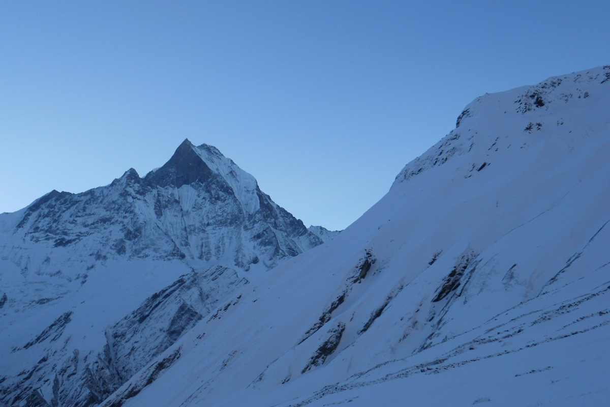
This region offers incredible diverse scenery, with high spectacular mountains and low land. The Annapurna route also offers the unique Gurung culture. Annapurna region trekking will show you the scenery of top mountains such like Dhaulagiri {8167m}, Manaslu {8156m}, Annapurna I {8091m}, Machhapuchhre {6996m}, Nilgiri {6940m},Tukche peak {6920m}, Annapurna South {7219m} & more.

Two main trails follow river valleys in relatively easy ascents: up the Kali Gandaki to Jomsom and Muktinath, and up the Marshyangdi to Manang. These trails can be joined by crossing a high pass, the Thorang La, and when combined they form the classic Annapurna Circuit. As the land climbs, mud-walled huts are replaced by flat-roofed stone houses, and the predominant occupation changes from farming to herding while the principle religion of the people changes from Hindu to Buddhist.

The Annapurna region dramatically reveals the cultural and geographic frontier running across Nepal. Mountain views are frequent and spectacular, and the various trekking routes offer different experiences – the trek around Annapurna leads you throughout the region, the Annapurna Sanctuary trek heads toward the heart of the Annapurna and the short trip to Poon Hill offers the best panoramic views in the region.

Package Details:

DEPARTURE/RETURN LOCATION Kathmandu
JOIN GROUP 1 before departure from Kathmandu.
SERVICE INCLUDES
Transportation to trekking starting point and from ending point
Trekking Information Management System Fee (TIMS Fee)
National park Conservation Fee
Lodge trek with all meals (breakfast, lunch, dinner) and accommodation in tea house lodge.
Services of English speaking trekking guide and porter (one porter for two people and the maximum weight carry by one porter is total 25kg)
Accommodation, meals, insurance, equipment and allowance of guide and porter.
Sleeping bag and down jacket if necessary.
All applicable government taxes and service charges.
SERVICE DOES NOT INCLUDE
Any accommodation and meals in Kathmandu
Any sightseeing tour in Kathmandu.
Any international and domestic airfare
Your personal travel insurance and medical.
Bottled drinks (mineral water, any cold drinks, and alcoholic drinks).
Expenses of personal nature such as tips for guide, porter, and driver, laundry, bar bill, telephone calls etc.
Liability for expenses against sickness, flight cancellation, road blockage, accidents, and other occurrence, beyond our control.
Nepal visa fee.
Any other optional services not mentioned above as included.

Annapurna Circuit Trekking
Lobuche east climbing in Nepal

Tour Reviews

There are no reviews yet.

Leave a Review

Rating